UC Berkeley · Capstone Project
Autonomous
SAR Rover
A compact robotic platform that enters damaged buildings after earthquakes to locate survivors, deliver first aid, and relay critical information — without putting responders at risk.
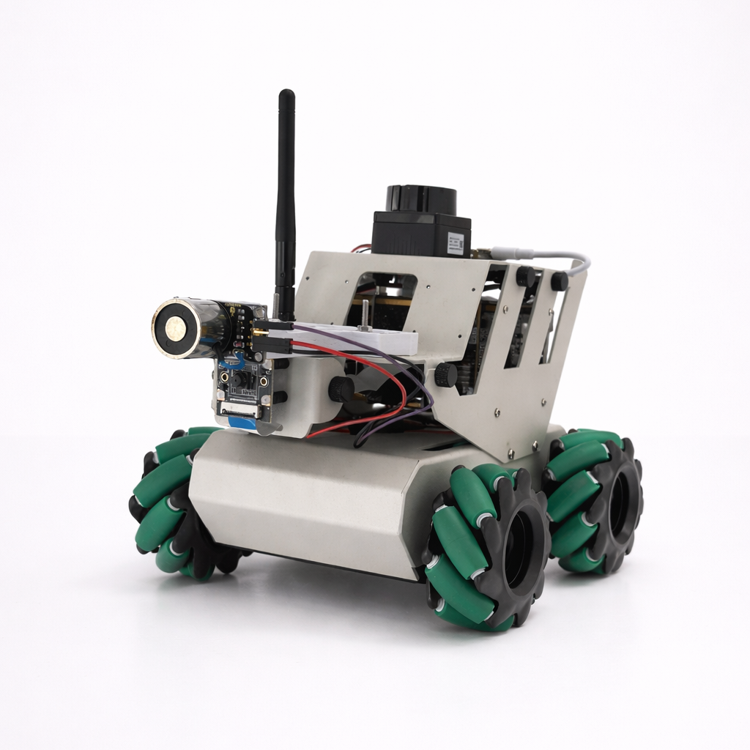
- Context
- UC Berkeley M.Eng Capstone · 2024–25
- Platform
- Yahboom RDK X3 · ROS 2 Foxy
- Autonomy
- SLAM · exploration · A* navigation
- Payload
- Electromagnetic aid-delivery arm
The Challenge
Earthquakes create a lethal window. The first 24 hours are critical — yet they are also when operating conditions are most hazardous for human responders.
of aftershocks happen within the first 24 hours of an earthquake
drop in a trapped survivor's chance of survival after the first 24 hours
of first responders are injured following a major earthquake
What Survivors Need
On-Site Care
Survivors often need first aid before evacuation. Life-threatening conditions like external bleeding can be treated by conscious survivors themselves — with the right supplies and guidance delivered early.
Psychological Support
Being trapped triggers severe fear and uncertainty. Knowing they've been found and having communication dramatically improves cooperation and survival odds while rescue is underway.
Rescue Path
When a safe path opens, survivors need clear, reliable guidance to reach the exit — minimising unnecessary movement that risks disturbing unstable structures.
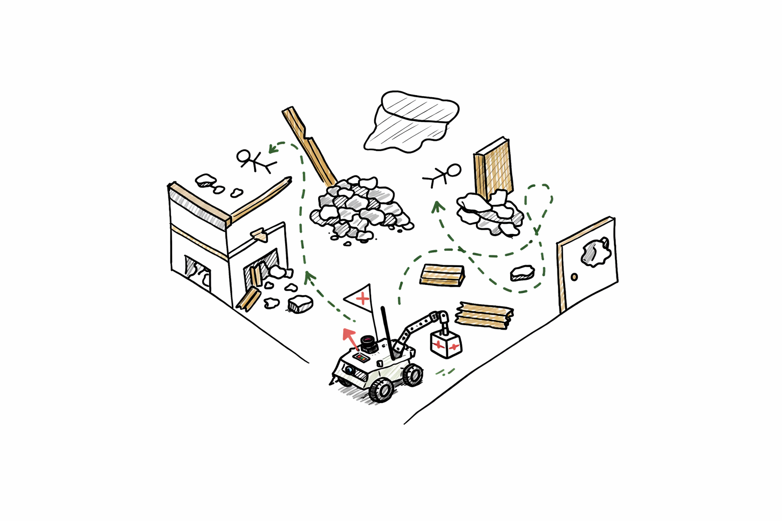
So we send the robot in first. It maps the interior, finds survivors, delivers aid, and reports conditions — before any responder steps inside.
Capabilities
Four subsystems, each a set of ROS 2 nodes, running together on a palm-sized rover.
Mapping
LiDAR, wheel odometry, and IMU data are fused into a live 2D map, giving the system the room layout and the robot's position within it — no GPS, no prior floor plan.
Navigation
The robot explores unmapped space on its own, planning paths with A* over the live map and re-routing around obstacles. Operators can also steer manually via the live camera feed.
Survivor Detection
The front-facing camera detects survivors and a converter node projects each detection from camera frame into map coordinates, so found survivors become navigation goals.
Aid Delivery
A custom electromagnetic arm carries first-aid packages to survivors. A magnet switch gives binary, repeatable pickup and release — no grasp planning required.
Software Architecture
The full ROS 2 node graph. Sensors feed the mapping and detection pipelines; both converge on a master script that plans navigation and commands the rescue tool.
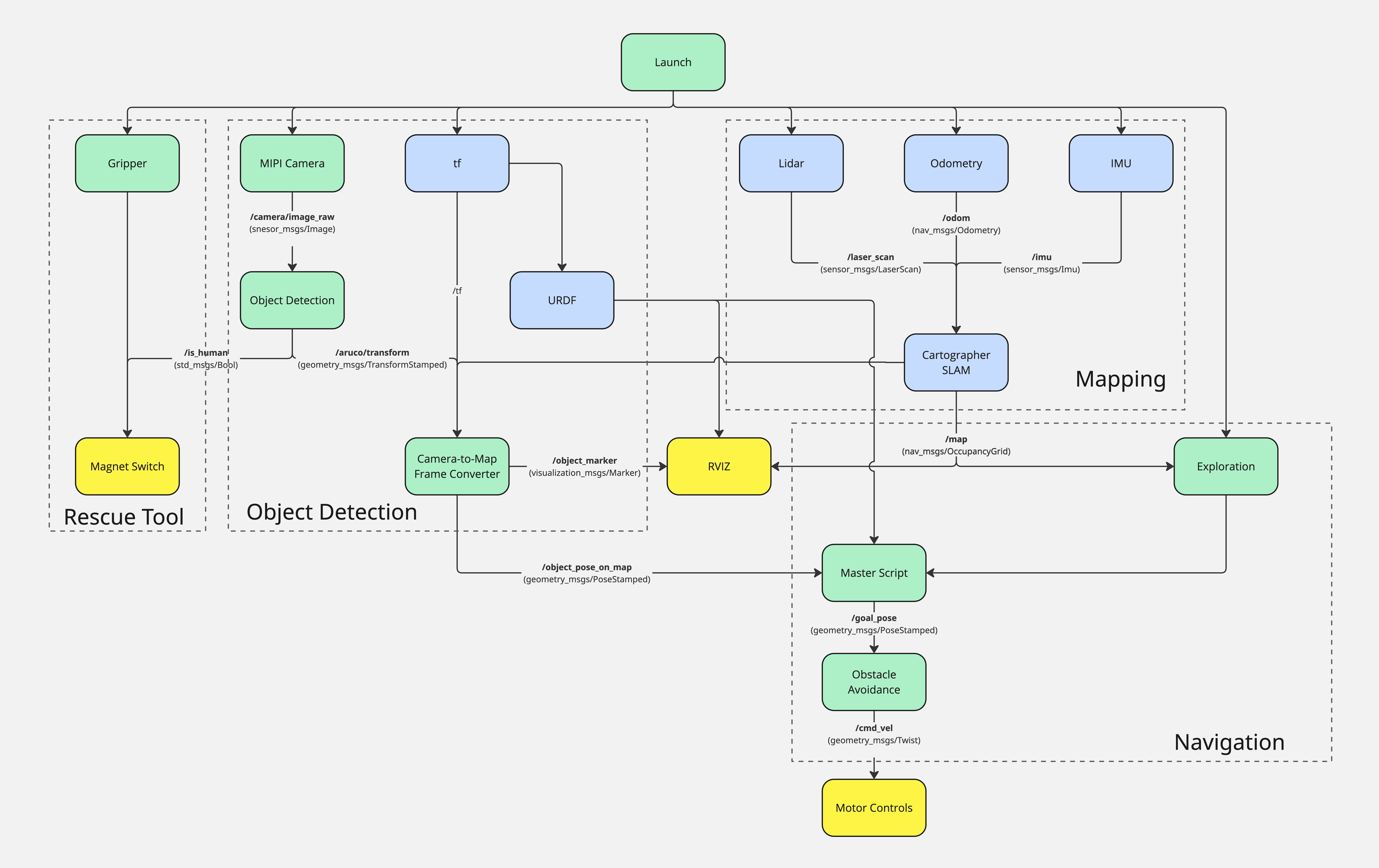
Click to open full size
Engineering Decisions
AprilTags as survivor proxies
Human detection wasn't the research question — the delivery pipeline was. Tags stand in for survivors so the full detect → localize → navigate → deliver loop could be proven end-to-end, with the vision model swappable later.
Electromagnet instead of a gripper
A gripper needs grasp planning and fails in unpredictable ways. Magnetic attachments on the aid packages reduce pickup and release to a single switch — reliable enough to demo repeatedly.
Cartographer SLAM with sensor fusion
Collapsed interiors are GPS-denied and cluttered. Fusing LiDAR scans with odometry and IMU keeps the map and pose estimate stable when any single sensor degrades.
Autonomy with an operator in the loop
The robot maps, explores, and navigates on its own, but RViz streams the live map and detections to an operator who can override with a goal pose at any time. In a rescue, a human stays in command.
Let's Connect
Building something? Let's talk.
jonathangoenadibrata@gmail.com